Drone-Based Wildlife Monitoring and Anti-Poaching System
Skaapwagter needed a surveillance system capable of detecting animals from drone footage to protect herds from poachers across large areas.
The Challenge
Monitoring large surveillance areas from the air makes animals appear very small, and real-time species identification is requires high computational efficiency. The organization needed a system that could detect heat signatures first and then perform high-resolution identification to confirm species and age groups without significant latency.
Our Solution
Architecture Overview: Aerial Conservation Intelligence
Skaapwagter's drone-based surveillance system provides a literal eye-in-the-sky for wildlife protection. By merging thermal vision with edge computing, the platform covers vast areas that were previously impossible to monitor manually, providing a proactive shield for endangered species and cattle herds alike.
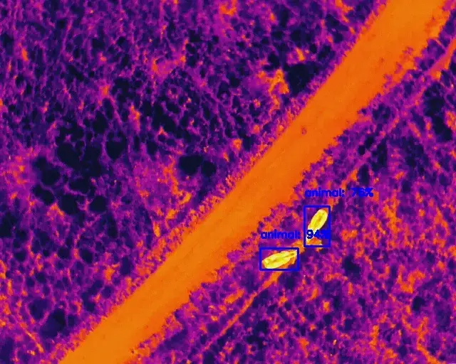
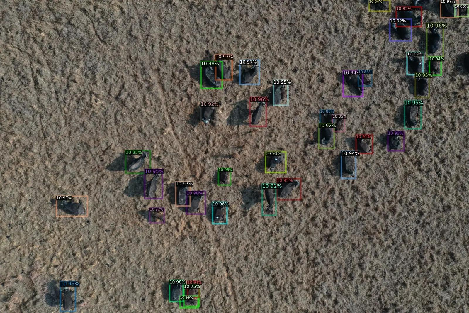
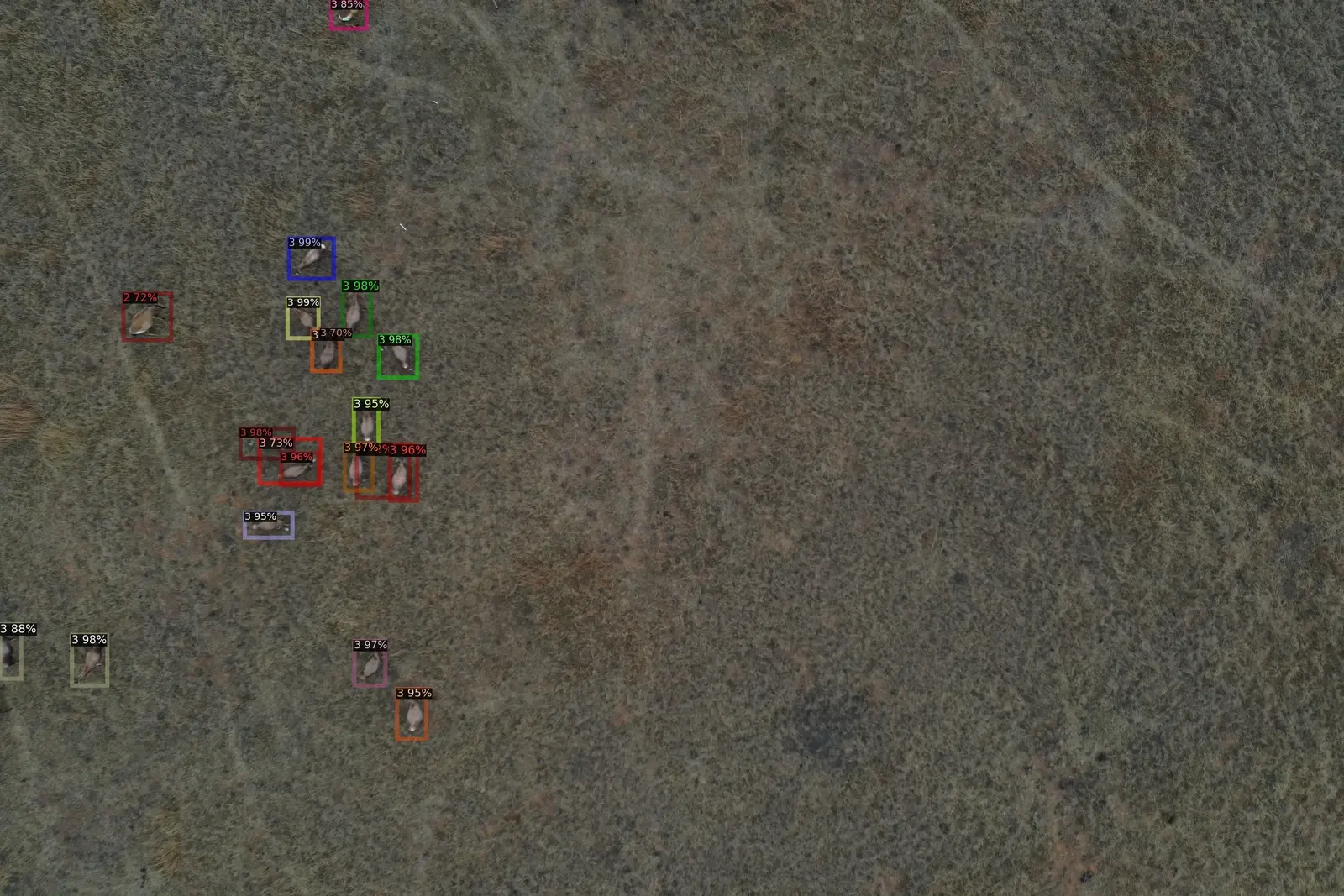
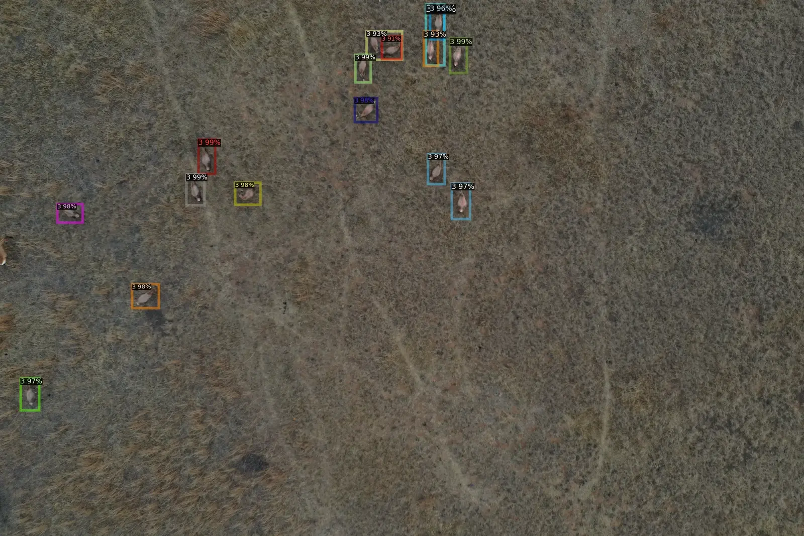
Aerial Intelligence Showcase
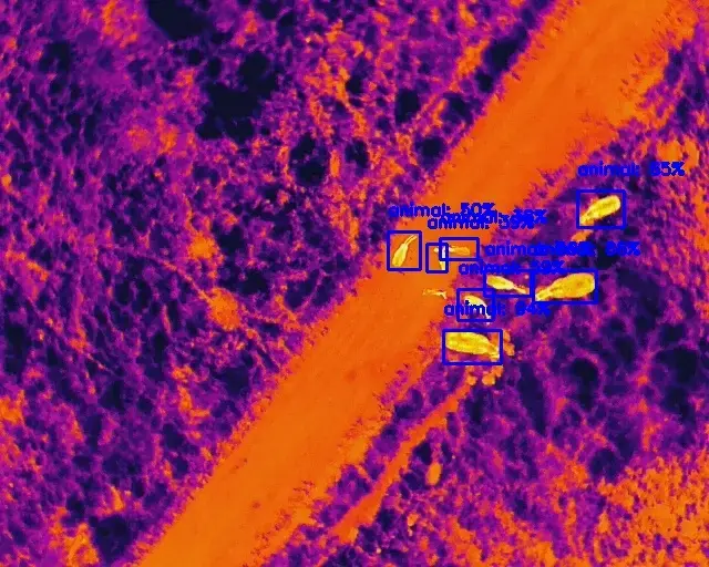
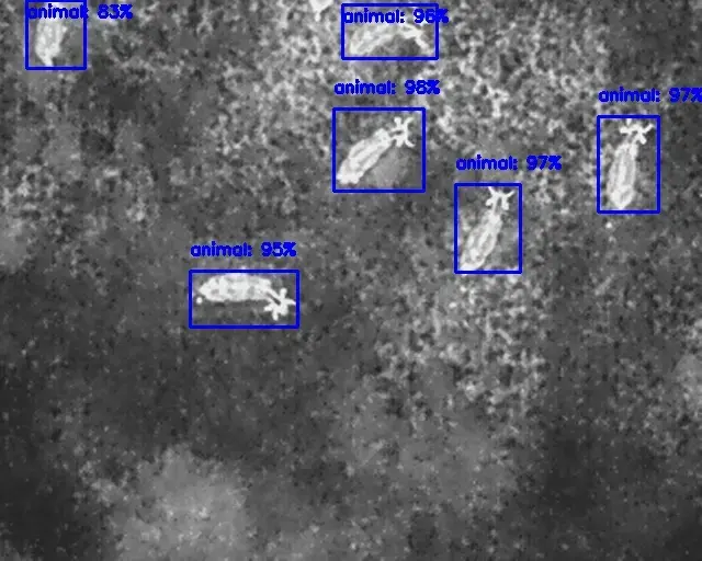
Dual-Stage RGB/Thermal Fusion
Implements a sophisticated two-stage detection pipeline designed for aerial monitoring. The first stage uses long-wave infrared (LWIR) thermal sensors to detect heat signatures from 100m altitude (98% recall), followed by high-resolution RGB identification at 50m to confirm species and age.
- LWIR Thermal Detection @ 100m
- RGB Species Verification @ 50m
- Multi-modal sensor fusion
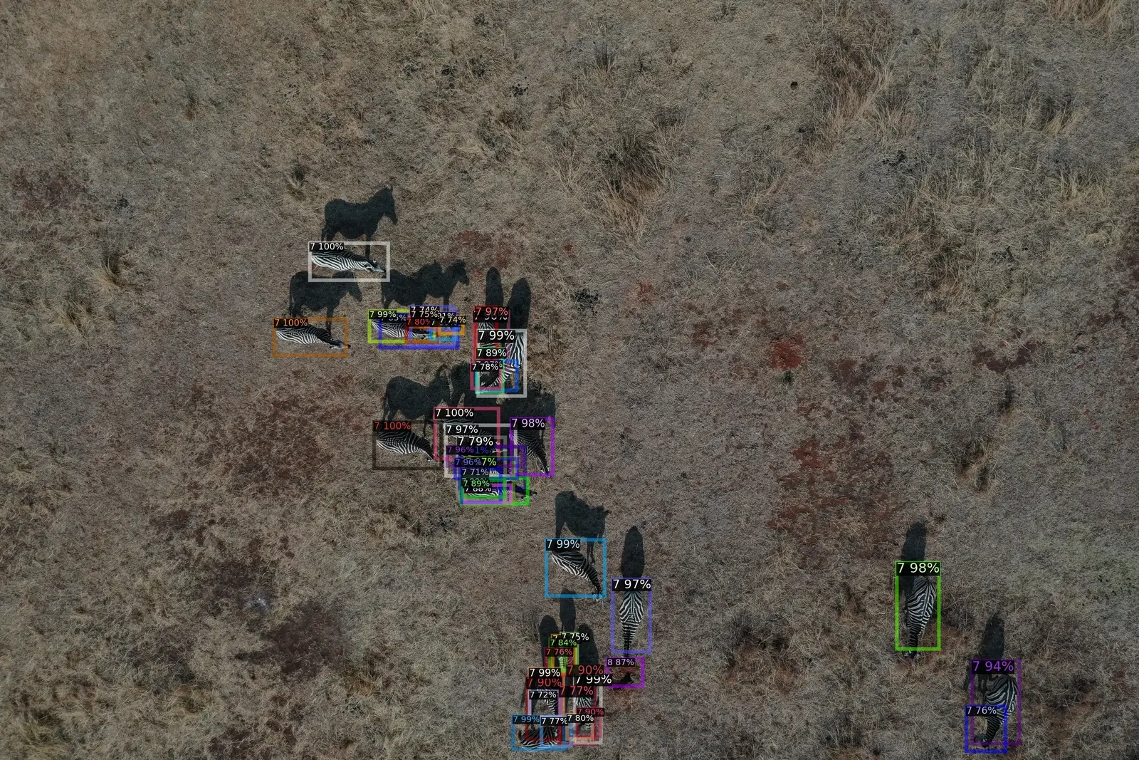
Aerial Perspective Object Detection
Custom-trained models optimized for nadir (top-down) perspectives. We utilized synthetic data augmentation to train the system on small object detection, accounting for rotation-invariant features and varying shadow patterns across large graze-lands.
- Rotation-invariant YOLO feature heads
- Small object sensitivity tuning
- Shadow-robust inference logic
Edge-to-Cloud Telemetry
The drone performs real-time detection locally on an NVIDIA Jetson module, transmitting only compressed coordinates and classification metadata via long-range (LoRa) radio links to the base station, which cross-references with satellite maps.
- NVIDIA Jetson Edge Inference
- LoRa Metadata Transmission
- Real-time Geospatial Mapping
Anti-Poaching Anomaly Detection
Beyond animal monitoring, the system identifies non-native signatures such as human thermal outlines or vehicle heat trails in restricted areas, triggering silent alarms and direct coordinate dispatch to ranger units.
- Human/Vehicle Class Detection
- Heat-trail Analysis
- Silent Threat Dispatching
Expanding Conservation Capacity
A single drone flight can cover more ground in 30 minutes than a foot patrol could in 8 hours, providing accurate, real-time population counts and vital anti-poaching security.
The Impact
The system provides continuous, large-area monitoring that acts as a powerful deterrent against poaching. By providing accurate, real-time data on animal density and movement, Skaapwagter has significantly improved its conservation efforts and responded faster to potential threats.
Start Your AI Consulting Services Partnership
Ready to take the first step towards unlocking opportunities, realizing goals, and embracing innovation? We're here and eager to connect.
Phone
+1 (737) 381-3933
Phone
+92 (314) 424-5425
USA
5900 Balcones Drive, STE 100 Austin TX 78731
Pakistan
585-H3, Johar Town, Lahore (Opp. Expo Center)